
Web Maps
User-friendly Maps
Map Toolkit for Every Purpose
Meteotest has its own map library with layers for point and raster data, time navigation, and other controls. The maps work on PCs, tablets, and smartphones.
Background maps from OpenStreetMap, swisstopo, Mapbox, or other providers can be integrated.
Examples
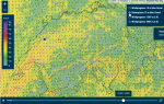
The following maps display high-resolution weather data at various zoom levels:
Wind forecast with wind direction and speed
Rain radar with satellite image
Bespoke solutions are also possible:
https://luftqualitaet.ch/

Ask our expert:
Stephan Loser
Co-Head of Software
| |